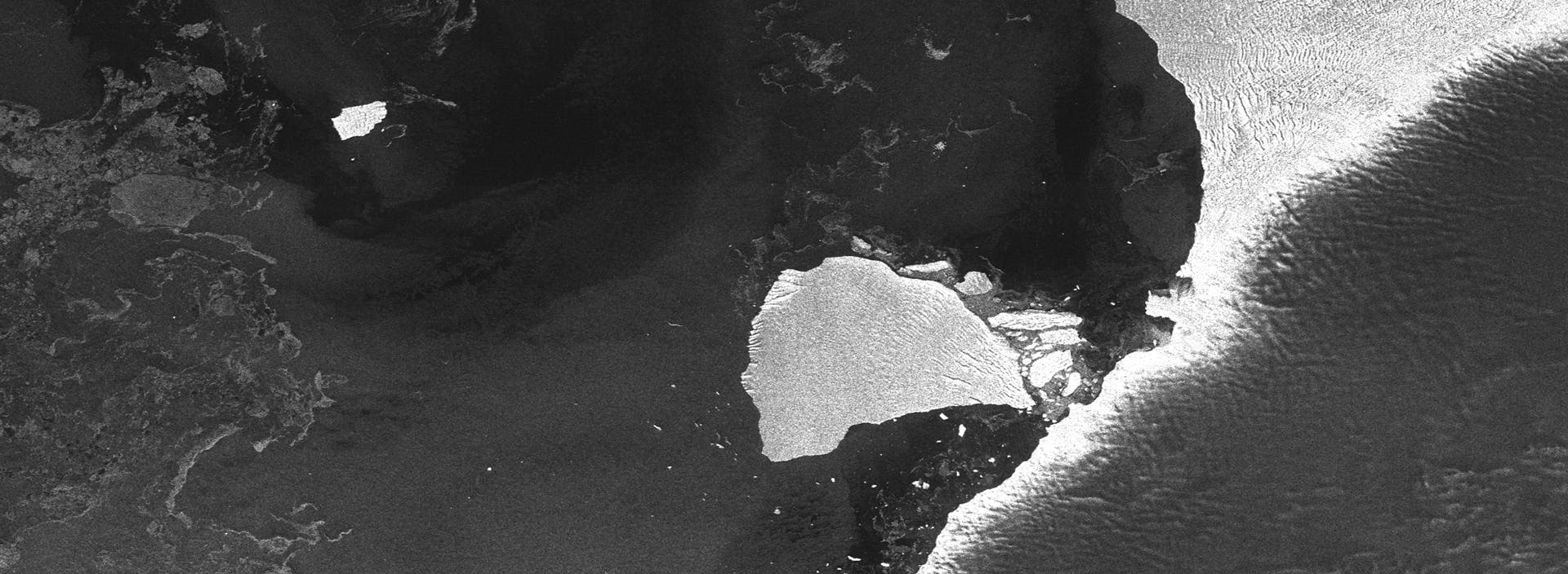
RADARSAT-2 image of Brunt Ice Shelf
Earth and space observation mission partner
Actionable imagery and insight in minutes MDA Space is the trusted partner of industries, organizations, and governments around the world whose missions involve detecting and monitoring changes caused by human and natural activities on and around Earth. Customers count on our advanced Earth and space observation solutions to deliver the timely, accurate mission-critical data they need, when they need it.

RADARSAT-2 imagery of Kolkata, India
RADARSAT-2 mission
The world's microscope from hundreds of kilometres above
As owner and operator of the RADARSAT-2 Earth observation satellite, MDA Space is one of the largest space-based radar information providers in the world, collecting, processing and distributing imagery from space to customers globally. The RADARSAT-2 mission operates under all weather conditions to provide access to near real-time imagery 24 hours a day, 365 days a year. To date, our extensive archive houses more than 1.1 million images of the Earth’s surface - totalling 90 billion square kilometres collected over the last decade and a half – and serves as a vast foundation for change detection analytics.
Our Earth observation services include analytics solutions that give customers information and insights to power decision-making –from environmental monitoring, disaster management, maritime domain awareness and security to mining, oil and gas, energy utilization, forestry management, and more.

MDA CHORUS™ mission
Powerful next-gen Earth observation capabilities
Building on the legendary RADARSAT heritage, MDA CHORUS™ is our next-generation Earth observation mission. A collaborative multi-sensor satellite constellation, CHORUS will provide the most extensive radar imaging capacity available on the market in one system, ranging from broad area coverage with a 700 km-wide swath to sub-metre very high resolution spotlight images. Yes, we can help you find a needle in a haystack.
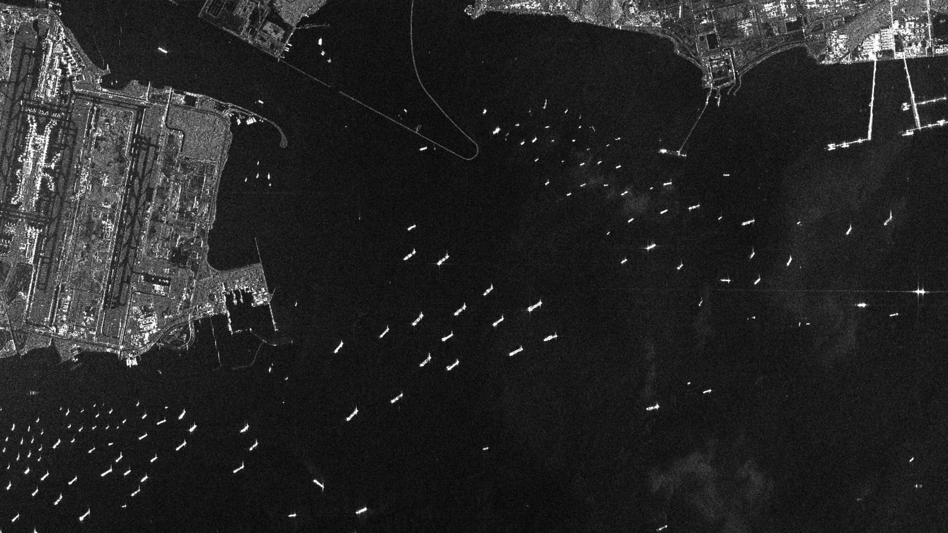
RADARSAT-2 imagery of fishing boats
Maritime domain awareness missions
Helping nations and people combat illegal, unreported and unregulated fishing
MDA Space partners with Canadian and international fisheries agencies to help in the daily fight against illegal, unreported and unregulated (IUU) fishing. Our Maritime Insights™ platform provides near real-time monitoring of fishing activity around the world, and delivers actionable data that supports dark vessel detection and maritime domain awareness.
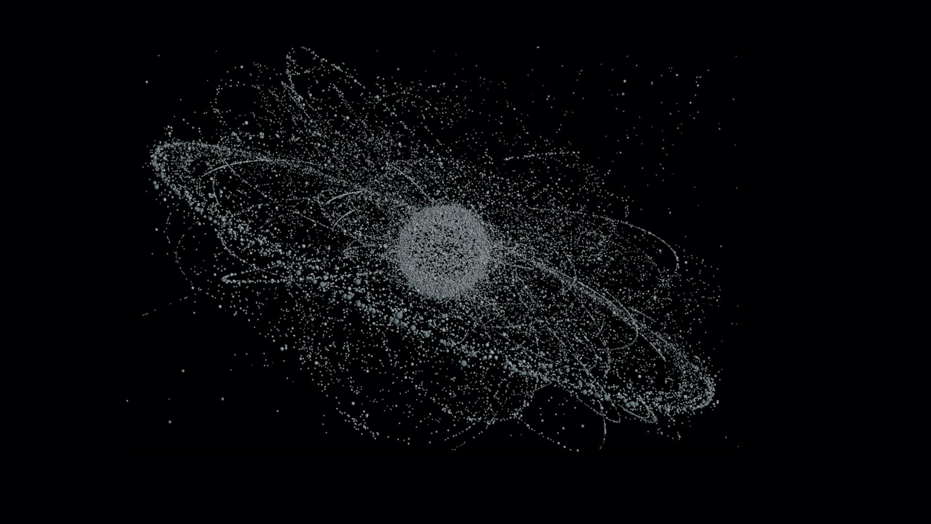
Space domain awareness: Sapphire mission
Tracking space debris 40,000 km above the Earth
Built by MDA Space, Sapphire is Canada’s first military satellite and a key space-based sensor in the US Space Surveillance Network. The Sapphire mission plays an important role in the surveillance of space by monitoring Earth’s orbit for man-made objects and space debris. Its data is used to predict and prevent collisions that could damage or destroy critical space-based infrastructure.

Mission enabler: Earth observation satellite ground stations
More than 70 ground stations in 25+ countries
Every day, customers worldwide rely on a global network of ground stations that we develop and build to deliver mission-critical information from Earth observation satellites – ours and others. We have installed more than 70 receiving ground stations in more than 25 different countries, which, over time, have processed data from over 20 different satellites. Our systems automate mission planning, imaging, data capture, processing and analytics, addressing critical needs for operators and users.